Mills in Alto Aragón - harinero, central eléctrica
Acumuer
Acumuer lies
deep in the valley that it gives its name.
From
Sabiñánigo follow directions
for
Larrés and the
Museo del dibujo. Take left when you reach Larrés
and follow the road below the village. You now enter the valley of the Río
Aurín and will pass several bore holes for natural gas.
Be ready for some potholes. You will cross the river after some time and
eventually reach
Acumuer. Park the car in the penultimate hairpin before
the village. Don't block the gravel road! Walk along the gravel road. At some point you
will cross the
GR. Follow the GR-markings and descend into the
riverbed. Once down, walk against the stream until you reach the mill.
Pictures: 20.iii.2002
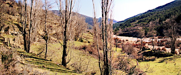
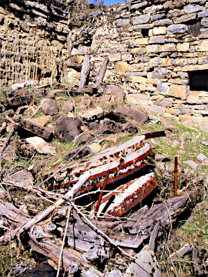
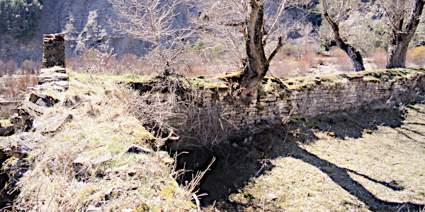
(1) Overview of the site: canal (left), pressure tube (center), pond and mill (right).
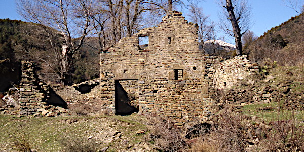
(2) Front of the mill with outlet.
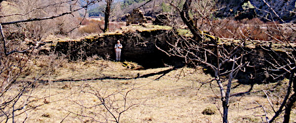
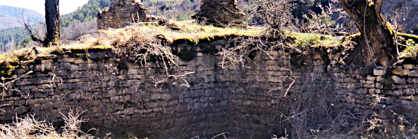
The mill is situated in the bed of
the río Aurín on a low platform. Thick walls behind the mill must
break the current and protect the construction against drift wood and
boulders. The protection dams are broken and some impressive trees
are swept against the remains. Soon, one day or another, dams, mill and everything will be swept away.
The façade shows scars from many renovations.
The lintel above the door opening (3) carries an engraving:
1763
. However, the mill
is probably older because in the archives of the local church a miller is already named in 1726
†.
Therefore, 1763 may be the year in which the current structure was erected, not when the milling business started.
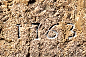
(3) Lintel above the door opening: 1763
.
A society,
La Hidroeléctrica Acumuerense,
for the production and supply of electricity to the village was founded in 1912 and existed until 1962
† at which time both activities were stopped.
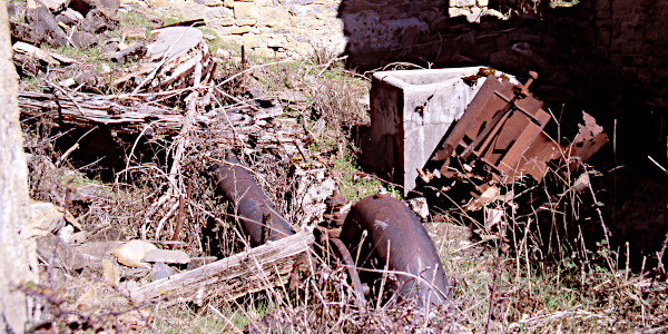
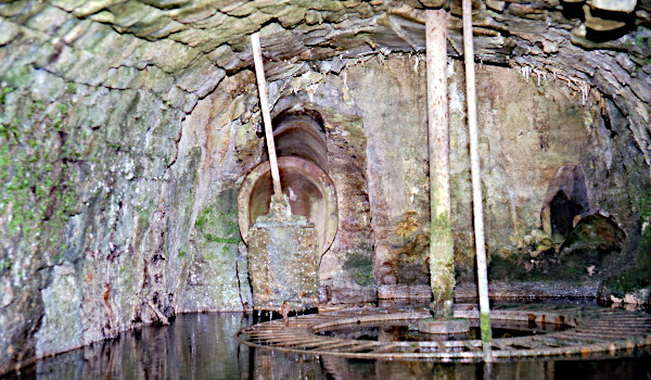
The mill is a complete mess (4), but some elements can still be recognized.
The arrows (4) point to the stones (6), the pressure tube, the Francis turbine (7). Next to the concrete vessel in the center we recognize
internals of a grain cleaner (5).
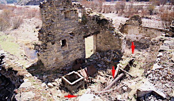
(4) Overview of the workplace.
(5) Stones, pressure tube, turbine, and remains of grain cleaner.
(6) One pair of mill stones; control rods.
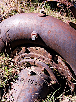
(7) Francis turbine for the central eléctrica.
The Francis turbine (7) with № 156 is made by
La Electricidad S. A. from
Sabadell.
Other turbines of the same brand can be seen in
Ribera de Castanesa
(№ 129), and in
Espés bajo (№ 142).
Each mill, the stones and the turbine, had its own separate source
of water. The mill pond (8) served only the grain mill and got its water from the river. The turbine was supplied, via a canal of about 200 m, with water from a tributary of the río Aurín.
(8)
The mill pond is huge with a depth of nearly 2.5 m at its deepest point near the mill where
the saetín (10) is. The walls are carefully constructed with regularly shaped, almost like bricks, natural stones.
The pond leans against the back wall of the mill. One of the containment walls (left in 9) is an extension of the back wall.
The other, perpendicular on the first, runs parallel with the river.
The channel enters the embalse at the outer end of this wall. Only the
last few meters are preserved. The rest is taken by the river.
The water flow to the turbine is entirely independent from the pond. The waterworks for the power station are described further on.
Notice how both flows cross each other in the mill (see 4).
The water for the flour mill comes from the right, from the pond, turns the stones, and then leaves to the left: the flow is parallel to the river.
The water for the generator comes from behind, runs through the pressure tube to the turbine, and afterwards turns left to the outlet: perpendicular to the river.
(9)
(10)
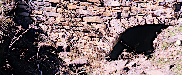
(11) Both drains share one restitution channel.
Only the cárcavo of the flour mill is accessable (11).
The other opening (discharge of the turbine) is almost entirely hidden behind debris. A short stretch of the arch can be seen left in 11.
At the time of our visit, the cárcavo was still in good condition
and contained all the usual components: a metal pressure pipe with a shut-off valve, a metal wheel, and the associated control rods,
which were also still visible next to the mill stones (6).
(12) The cárcavo of the flour mill.
† Jesús Montuenga Ruiz
— 2025— Érase una vez un pueblo llamado Acumuer. Ed. Amigos de Serrablo, Ayuntamiento de Sabiñánigo, Instituto de Estudios Altoaragoneses

