Mills in Alto Aragón - harinero
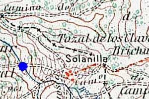
Solanilla

Solanilla, or Solaniella on some recent maps, though remote nowadays is not too difficult to reach. Take the main road between Boltaña and Lanave where near the Molino Escartín Aineto is signposted. From Aineto —though I prefer the walk— it is possible to continue by car to Solanilla.
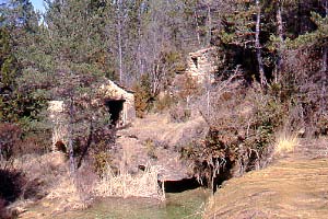
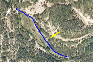
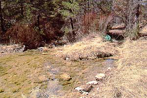
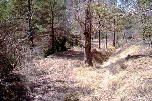
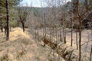
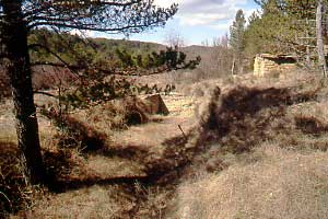
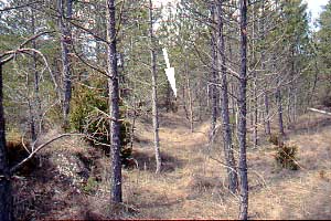
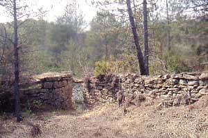
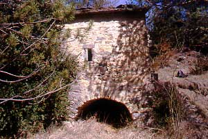
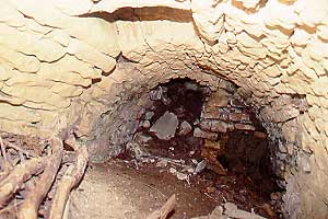
The molino is situated less than a kilometer away from the village. From the church (south of the village) follow the path leading to the west into the valley. After about half a kilometer you should get at the river near the start of the canal. It may be necessary to walk a bit hence and forth to find the exact spot. From there follow the channel and after less than 400 m you'll come at the mill. The mill is built on the Barranco Ricau.

Pictures: 23.iii.2008

(1) Overview of the site: mill with pool;
wall of mill pond in background
The molino is built in a truely lovely environment with a waterfall and a pond with clear and inviting water. Because of the drop after the waterfall it was possible to build the mill safely above the flow while still securing enough depth below the reservoir (1).

The mill is a solid construction and features all the essentials of the trade, but is remarkably absent from any of the 1:50000 maps of the Instituto Geográfico Nacional: the editions of 1935, 1953 and 2003. The blue dot in fig. 2 fills the void. Notice also the powerline: Solanilla is connected with the grid of Aineto.

(2) Location of the mill relative to Solanilla
(3) Canal drawn on aerial view
©Instituto Geográfico Nacional de España

(4) Start of the canal (right)
(5) Canal first dives below path
The humble rivulet is broadened and shallow where it is dammed (4). The azud is made from stones loosely stacked and almost as much water passes through than over. The canal starts with a valve and a makeshift construction with a rusty car door.
The canal is first tuneled below the path (5) giving access to the meadows visible in the aerial (3). It is very well defined and after some time broadens into kind of an intermediate reservoir annex washing board (7 and yellow arrow in 3). The canal then continues and after 400m opens in the embalse (8 and white arrow in 3).

(6) Canal lined with trees during first half
(7) Arrives at washing place

(8) Canal enters the reservoir
(9) Outlet of pond towards mill
The embalse is rather large (8: the white arrow indicates the back) and planted with pines. Pine planting was only one of the nasty habits of the Spanish ICONA (Nature Conservation Institute).
The water was stored high above the cárcavo as is illustrated in (1). The roof of the mill (visible between the walls in 9) is level with the base of the reservoir.

(10) Wall with mouth of cárcavo
(11) Empty cárcavo
The cárcavo is wide open, in good shape but empty. A small window throws light on the stones inside.
A wide cárcavo topped with a window: we've seen it at more mills in the region (e.g. Bara, Abellada)

Path: Home / Alto Aragón: old mills / Solanilla
Introduction
Learn about the parts of a mill
Visit the mills; catalogue
Literature and other websites
© and e-mail: