Mills in Alto Aragón
Ciscar
Ciscar is a small village in the Ribagorza region of Huesca province.
From
Benabarre take the N-230 to the south, towards
Lérida.
After a few kms turn left for
Caladrones and
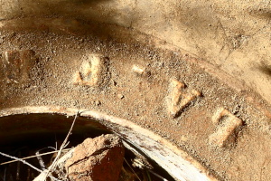
Ciscar (HU-V-9323).
Park your vehicle next to the bridge at the entrance of the village. Walk through the village and then find the signs for the GR-18 to the north.
Follow this GR-18 which longs the river
Cajigar and slowly descends.
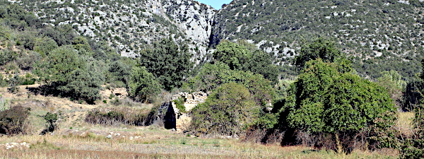
After about 600m the track ends in the river bed about 100m south of the mill at the end of the row of trees which mark the restitution channel
(see 12). The GR turns right towards the river, the mill is straight ahead.
Pictures: 4.x.2022
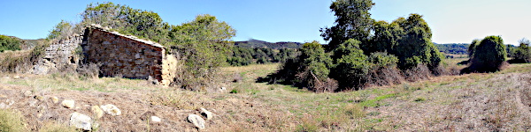
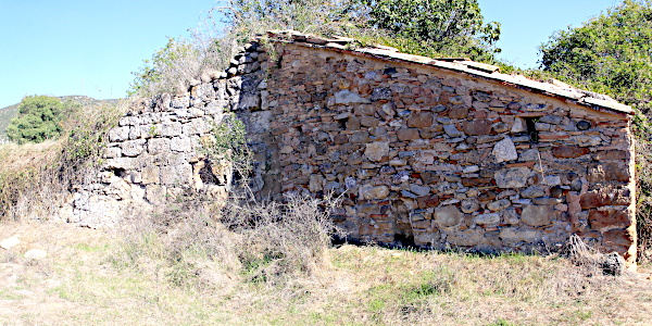
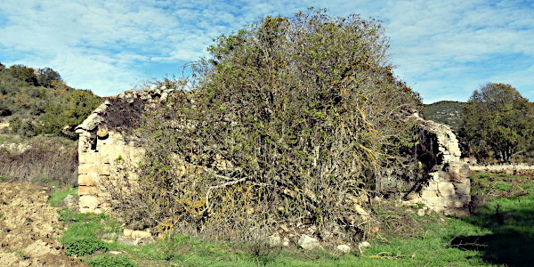
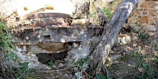
The mill is in very bad shape. The roof has collapsed and the front facade (4) has largely disappeared. The entrance is in the east-facing (right in 4) side facade and opens into a small reception area that connects to the workplace with the stones.
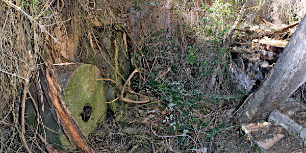
A part from the stone couple (5) no other equipment was found.
Opposite the millstones stand two edge-stones (6) that could be useful in an oil mill, but not here.
Their diameters are 160 and 116 cm, and both are 50 cm thick.
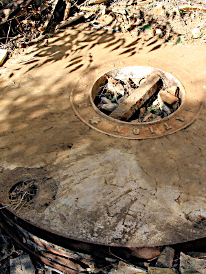
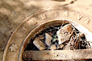
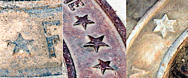
(10) La Ferté written with an underscore.
Also note the presence of an underscore between
La
and
Ferté
(10). The official spelling, which we also find on stones from the previously mentioned suppliers, is without an underscore. A genuine manufacturer from La Ferté would not make this mistake. My conclusion is that these are not stones from a major brand. Are we dealing with counterfeits? Or is it just name-dropping: the stones are composed like those from La Ferté, but they are made elsewhere. The answer to this question can only be given through research in the archives of the mill, the seller, and his supplier.
A similar stone rests in the mill of Cortillas (Molino de Cosme). Perhaps premium brand stones were out of reach for small mills which had to make do with brands that only alluded to the famous origin.
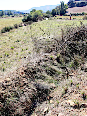
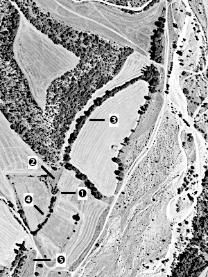
Behind the mill (12 ①) lies a relatively large pond (11) which is clearly visible in the aerial photographs
(12 ②). The rest of the waterworks can also still be clearly recognized in the landscape. The canal is bordered by trees (12 ③) and can easily be followed about 300m to the north to the Cajigar river. In the field notes of the IGN map MTN50-0289 (1948), a toponym La Presa
appears here, which is not included in any printed version. We could not, however, find any trace of a former dam. Finally, we followed the row of trees further to the north to the entrance of the
congosto
. Again, without being able to discover any trace of a canal or a dam. Perhaps there was never a permanent dam, and a temporary dam was used and rebuilt every year.
The row of trees south of the mill (12 ④, 4 right) grows along the restitution canal that carried the water back to the river after the work was done. The water was not returned directly to the río Cajigar. The restitution canal flows into the
Barranco del Romeral (12 ⑤), a tributary that runs parallel to the río Cajigar for a distance before flowing into it.